Please excuse my post title. Hovenweep: Home of the Ancients is probably not the best title I’ve used on this blog. I didn’t realize it as I was brainstorming this post title, but it sounds like an absolutely unintended sports cliche. Washington: Home of the Redskins Commanders or Cleveland: Home of the Indians Guardians or Hovenweep: Home of the Ancient Enemies Ancient Ones. Maybe I’ll get it all correct one of these days, but it’s hard to do when they keep moving the goalposts.
Hovenweep is no joke, it was once home to something over 2,500 people living in six prehistoric villages built in the 1200’s C.E. That’s a greater population density than the area could support today, so obviously things were different then. At least they were different for a while.
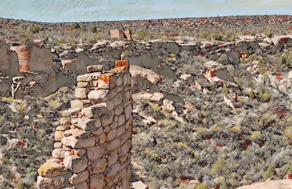
The best we can tell, by the end of the 1300’s they were gone, all the structures they built were abandoned, most pulled down, and many put to the torch. Not just Hovenweep, but within a generation or two the Anasazi disappeared. Everywhere. The civilization they had so painstakingly built, brick by brick, was gone. All across the North American Southwest; Colorado, New Mexico, Utah, and Arizona, they were gone. We can make guesses about their fate, but to my knowledge no absolutely definitive proof of their final destiny exists. None. No witnesses were left behind. Everyone was gone…
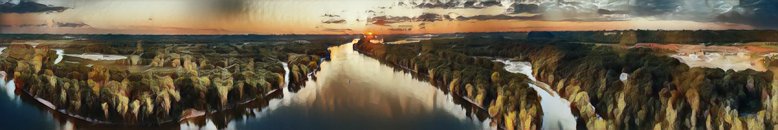
The environment in the desert southwest can be variable to say the least. It can open up and pour enough rain to cause a flash flood, but the next valley over can be dry. When rains do come they are often in the form of what locals call “monsoons” during what they call “monsoon season”. On an 80° day with bright blue skies in Professor Valley north of Moab, I drove south and experienced a bone chilling hailstorm not far south of Moab. Never have I ever seen hail in anything like the quantity we saw that day in Utah, it piled up and covered the desert with a coat of what appeared to be snow, but was actually ice.
If you’re from the East Coast, the dryness of the land here is nearly incomprehensible. Even the sky is a different color than what is found closer to an ocean – it’s a darker hue with more depth, it’s a far deeper blue. Although we have have droughts in the Midwest, we’ve never known this kind of dry, not while I’ve been alive. As I write the relative humidity here in upper Mississippi Valley is 52% with a 59° dew point – that’s relatively dry for us here in Iowa/Illinois.
Two days ago, when the temperature here was close to 100°, I looked and the relative humidity in the Mississippi Valley was 81%. My Microsoft weather map says it reached 99° today in Moab, Utah, with only 10% humidity and a 31° dew point. That’s no typo – 10% humidity, and 31° dew point on a night where the predicted low is 66°! The air dries out your skin and eyes, it dries your nose and mouth too.

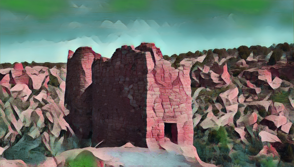
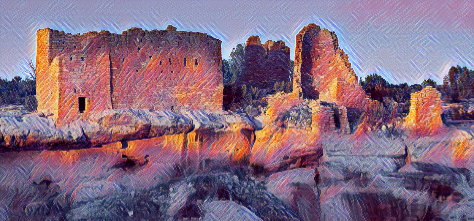
Hovenweep National Monument protects six prehistoric, Puebloan-era villages spread over a twenty-mile expanse of mesa tops and canyons along the Utah-Colorado border. Multi-storied towers perched on canyon rims and balanced on boulders lead visitors to marvel at the skill and motivation of their builders.Human habitation at Hovenweep dates to over 10,000 years ago when nomadic Paleoindians visited the Cajon Mesa to gather food and hunt game. These people used the area for centuries, following the seasonal weather patterns. By about A.D. 900, people started to settle at Hovenweep year-round, planting and harvesting crops in the rich soil of the mesa top.
The name “Hovenweep” translates to “deserted valley” in Paiute/Ute. The ruins that form Hovenweep National Monument are located very close to the southern borders of Colorado and Utah. The former villages span an area of about 20 miles, forming a total grouping of six Anasazi Ancestral Puebloan ruins. Four of the sites: Holly, Horseshoe and Hackberry, Cutthroat Castle, and Goodman Point, are located in Colorado near, or on, Paiute/Ute lands. The other two: Square Tower, and Cajon, are in Utah closer to current Navajo tribal lands.
The ruins are set upon Cajon Mesa in the Great Sage Plain, a vast expanse of rolling, sage-covered uplands stretching north and west from Mesa Verde to the red rock country of southeastern Utah. Dissected by hundreds of canyons and punctuated by large stands of pinyon pine and juniper, it seems to be a relatively inhospitable landscape but was actually pretty abundant in the natural resources the Ancestral Puebloan people needed to thrive. Deer and other small game were at least somewhat plentiful for hunting, there were pinyon nuts, juniper berries, and other wild plants to forage.
Perhaps the most important attribute, soils around Hovenweep were relatively deep, which led to more assured success growing corn, squash, and beans (the Three Sisters). If the rains came when needed, harvests should have been plentiful. Archaeological surveys have documented tens of thousands of Pueblo and other archaeological sites across the Great Sage Plain.